
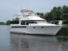
Coming into Carrabelle

High Tide

Low Tide
A little history on Apalachicola – founded in 1831 as a port to ship cotton. After the civil war lumber replaced cotton, the railroads supplemented the ships and the town grew to an important port along the panhandle. By the time the lumber industry had cut all the pine trees, the shrimp and oysters industry was taking over. If you have oysters in Florida there is a 90% chance they came from this area.
Yesterday (Wed) it rained ALL day. It would stop and we thought about going for a bike ride but 5 minutes later it was raining again. We had to adjust our lines but one problem was we were tied to a floating dock on one side and a permanent dock on the other. You can see from the one picture where the water was low when we tied up and how much the tide rose.
It finally cleared off about 5:00 P.M. so along with Ross and Nancy we rode bikes to “That Place in Apalach” for dinner. The food was good but we were their only customers and I think we were also the only people on the street to enjoy their festive Christmas decorations. Nothing happens here through the winter months. Many places are closed for the season.
Tom was all snug and warm in bed when I woke him to say Ross had alerted us that they had moved their bikes to avoid the possibility of the water getting to them. Out we went in our rain gear into the dark cold dreary night to move them to higher ground.
We cruised Apalachicola Bay for 30 miles past the St George Bridge and Dog Island to Carrabelle. This is the end of the Intracoastal Waterway and our last stop for provisions. Now we have to wait for good weather and make the decision of whether to go 180 -200 miles across the gulf traveling through the night or cruise the more protected “Big Bend” route where you stop at Steinhatchee, Cedar Key, Crystal River and then Tarpon Springs. The Big Bend is often shallow and may have weather delays of up to several days.
No comments:
Post a Comment